Tracking moose and salmon with GPS
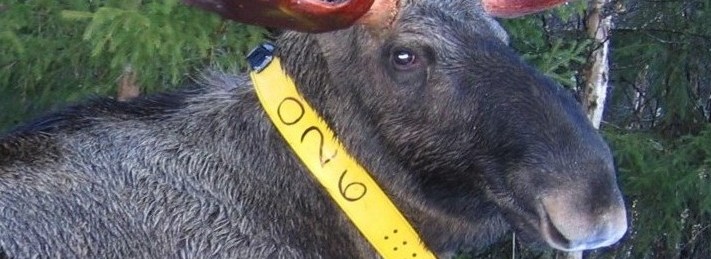
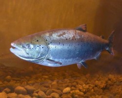
Biotelemetry technology for wildlife and fish monitoring has evolved tremendously since the 1990’s: from moose and reindeer wearing collars with primitive radio transmitters weighing several kilos, to salmon with miniscule bio-sensors, and eagles wearing solar powered GPS-backpacks containing cameras and accelerators.
This giant leap in monito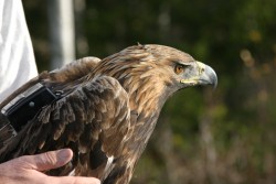 ring technology has opened up exiting possibilities for researchers. But it also produces torrents of data, opening up a gap between the volume of data available and the tools for handling it.
The people from WRAM, the Umeå Center for Wireless Remote Animal Monitoring, are closing this gap, not only for their own benefit but hopefully for the benefit of the global wildlife research community.
Researchers sharing data
Based out of the Swedish University of Agricultural Sciences in Umeå they have created the WRAM data management system and e-infrastructure for automatic reception, long-time storage, sharing and analyzing of biotelemetry sensor data from animals.
One of the key features of the system is a true data federation layer, enabling researchers around the world to easily cooperate and share data with each other, through high capacity research and education networks.
Head of WRAM, Holger Dettki, explains: “20 years ago, when very high frequency (VHF) collars were standard, a field study could require numerous research assistants recording a few positions every week.
“Now, the researchers can amass more sensor readings in a fortnight than VHF allowed in five years.”
“In 2003, the first animal collars with a GPS sensor and integrated data transfer, using mobile phone networks, hit the market. Since then, techniques have matured.
“The cost of tags, sensors and transmission methods has been reduced, and many new biosensors have been developed. This gives today’s ecologists a huge opportunity to research an individual animal’s behavior and physiology in the wild, which was not possible before.”
Too much data
But, according to Holger Dettki, due to the huge amount of data available, single research groups are often unable to analyze their data in a timely fashion.
Also, they want to share their data with similar research projects to obtain synergy effects. WRAM makes this possible, enabling fish and wildlife researchers and managers to access and analyze similar animal sensor data from different database systems throughout the world in a unified and efficient way using a single web portal.
Accessing hitherto redundant data sitting in isolated local databases and facilitating collaboration on an international scale, Dettki has high hopes for this revolutionary new data management system:
The Big Data challenge
I foresee WRAM becoming one of the most important scientific infrastructures for receiving, storing and sharing of biotelemetry sensor data. Big Data is a huge challenge for ecologists, as it will be for many other research areas in the future.
WRAM is a respon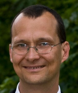 se that challenge. You can no longer rely on spreadsheets or simple text files, if you are an ecologist with an ambition to do high end research.
Regrettably, some funding agencies and some members of the research community still believe that. But with the staggering amount of biotelemetry data coming in, we need tools, that are much more powerful.
Currently, the WRAM e-infrastructure is spreading around the globe, serving users and projects in all Nordic countries, Europe and Africa.
As this is happening, even more possibilities of synergy between different systems are opening up. As an example, WRAM plans to enable researchers to interface with the new Environmental-Data Automated Track Annotation system, developed by WRAMs collaboration partner MoveBank in cooperation with NASA.
This means, that you can synchronize your position data with up to 19 global environment variables found through satellite photo analysis, making it much easier than before to understand, how animal behavior is affected by environmental conditions.
Holger Dettki, head of WRAM, the Umeå Center for Wireless Remote Animal Monitoring
For more information please contact our contributor(s):